地球资源数据云——数据资源详情
国家坐标(世界)
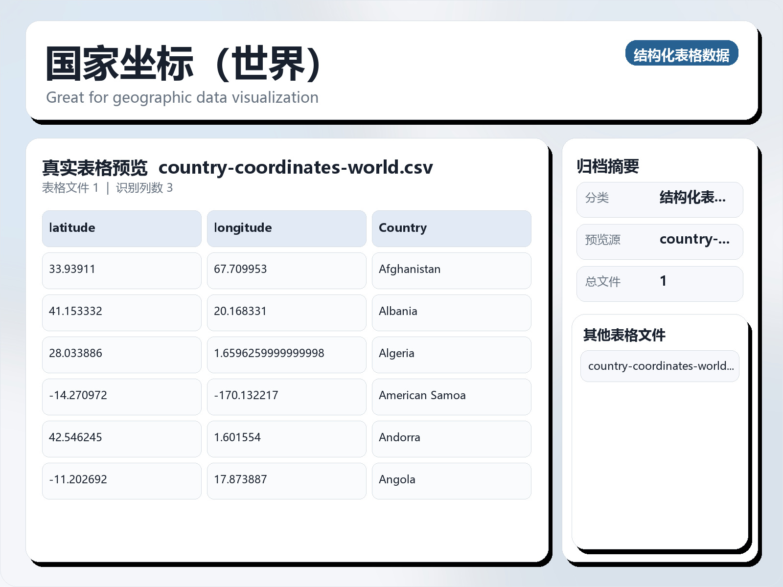
该数据集《Country Coordinates (World)》主要用于监督学习任务,数据形态以表格为主。 题目说明:Great for geographic data visualization 任务类型:表格监督学习。 建议流程:先做缺失值/异常值处理与特征编码,再比较逻辑回归、随机森林、XGBoost。 评估建议:使用分层切分或交叉验证,优先关注 F1、Recall、AUC 等分类指标。 可用文件:country - coordinates - world.csv。 While working on geographic visualizations, I needed to generate overlays for the world map. All I required was the latitude, longitude and the complete, official name of the country. So I generated this data which should save you a lot of time on data cleaning. This data set is arranged in alphabetical order. Acknowledgements The Data was sourced from Google: https://developers.google.com/public - data/docs/canonical/countries_csv License: Attribution 4.0 International (CC BY 4.0)
摘要概览
该数据集《Country Coordinates (World)》主要用于监督学习任务,数据形态以表格为主。 题目说明:Great for geographic data visualization
任务类型:表格监督学习。
建议流程:先做缺失值/异常值处理与特征编码,再比较逻辑回归、随机森林、XGBoost。
评估建议:使用分层切分或交叉验证,优先关注 F1、Recall、AUC 等分类指标。
可用文件:country - coordinates - world.csv。
While working on geographic visualizations, I needed to generate overlays for the world map. All I required was the latitude, longitude and the complete, official name of the country. So I generated this data which should save you a lot of time on data cleaning. This data set is arranged in alphabetical order.
Acknowledgements
The Data was sourced from Google: https://developers.google.com/public - data/docs/canonical/countries_csv License: Attribution 4.0 International (CC BY 4.0)
常见问题
国家坐标(世界)是什么?
该数据集《Country Coordinates (World)》主要用于监督学习任务,数据形态以表格为主。
国家坐标(世界)是什么数据格式?坐标系是什么?
数据格式为 CSV。
国家坐标(世界)是如何生产或处理的?
So I generated this data which should save you a lot of time on data cleaning.
如何获取并引用国家坐标(世界)?
在本页登录后即可下载。建议引用格式:地球资源数据云. 国家坐标(世界). https://www.gis5g.com/dataset/2031264073742979074